

(My previous trip to Death Valley and Racetrack Playa is detailed here)
So I went back to Death Valley at the end of February. I had some friends who had expressed an interest in seeing Racetrack Playa, and I wanted to take another (Better informed) swing at astronomy photography. Between us we came up with several destinations for a longer trip than just the out-and-back one-nighter that Michael and I had gone on in 2013. I also arranged ahead of time to rent a Jeep. The 27-mile drive from Ubehebe Crater to Racetrack Playa had taken 3 hours on the previous trip and I was determined that it would be faster and more comfortable this go ’round.
We started early on a Friday morning. I began rounding up the guys at about 5:30 AM. We shoved all our various camping gear in the the back of my minivan and made for the grocery. We purchased nearly every type of pork product available along with booze, peanut butter, some smoked gouda and a nice Stilton, then we were offskie.
First stop…. Sonic in Pahrump, because none of us had eaten breakfast.
Second stop… Dante’s View! One of our number (Tim) had pointed out that several Second Unit scenes for the original Star Wars were shot in Death Valley. I’d looked online and found a few helpful sites but most were pretty light on coordinates. Tim came equipped with a folder full of printouts with screen captures and directions, mostly culled from Star Wars in Death Valley.
Dante’s view isn’t hard to find. From California Highway 190 turn south onto Furnace Creek Road. In about 7 ½ miles this road turns into Dante’s View Road and Furnace Creek Wash Road splits off to the left. Continue ahead on Dante’s View Road. Just under another 6 miles and you’ll reach the viewing area. It’s all paved and you can reach it in a street vehicle.

Looking north along Death Valley from Dante’s View
In the original Star Wars Luke decides to travel to Alderaan with Obi Wan Kenobi after his family is murdered by Stormtroopers trying to recover R2-D2 and C-3PO. They make the trip overland to Mos Eisley by speeder. The first we see of the infamous spaceport is from a peak high above.

Side by side comparison of Mos Eisley with Death Valley
While Sir Alec Guinness and Mark Hamill were standing on a ridge in Tunisia, their view of Mos Eisley was filmed from Dante’s View looking north along Death Valley.
As Tim explains:
(I’m pretty tickled with how well these little video snippets turned out. Go into the YouTube settings and watch them in HD. Not great works of cinema mind you, but they look a lot better than I expected)
I find it fascinating that in the film shot they left the road in the picture.
From Dante’s View we traveled down to Badwater, the lowest point in North America. From the parking area at the side of the road you only need walk to the bottom of the stairs to see a small pool of spring water. The water is so salty as to be undrinkable, hence the area’s name. If you look around and up the cliff on the opposite side of the road you can see the “Sea Level” sign some 280 feet up the rock face. From the parking area you can set out across the salt flats. They are packed flat in a line approximately 50 feet wide that runs almost due west from the road for about half a mile, compacted by the feet of thousands of tourists. I picked up a pinch of salt from the virgin crystals just beyond the the worn path and tasted it. It was much warmer down here on the valley floor than it had been at the peak, and after trying the salt I drank down about ¼ of the water in my CamelBak.
While we’re on the subject of water allow me to remind you that the name of the place is Death Valley. The entire area is pretty wildly inhospitable to all but the most specially adapted life (The Badwater Snail, for example… that lives in Badwater Spring). TAKE PLENTY OF WATER WITH YOU. No matter when you travel to Death Valley it is dry. Temperatures were mild during our visit, and we still went through approximately 2 gallons of water a day between the four of us. Just because it isn’t hot, that doesn’t mean you can’t get dangerously dehydrated. I will post here the handy-dandy urine color hydration gauge we found in the bathroom at Scotty’s Castle.

Pay close attention
You’ll find water fountains at ranger stations and, to my surprise, several of the camp sites (But not all). I advise bringing your own in abundance. We discovered that water cost more per gallon than gasoline at Stovepipe Wells, and gas in Death Valley ain’t cheap.
We left Badwater and rolled back north to Artist’s Palette. The area is so named for the many different colors found in the area due to various minerals in the rocks. The area is quite lovely. There is not only an incredible variety of colors to be found, but the different shades change subtly at various distances.
But that’s not why we came….
We stopped at Artist’s Palette because another 2nd Unit scene for Star Wars was shot at this location. Just before R2-D2 is captured by the Jawas we see a shot of him rolling up out of an arroyo. We hoped to find the exact location from which this segment was shot. We parked in the dirt lot and made our way up the arroyo, Tim with his printouts in hand. Gerry and Mike hiked further up toward the hills while Tim and I scrambled up and down the ridges dividing the narrow channels that come together just at the parking area. We were trying to line up the view with the screen shot just… so.

Obviously, I don’t own this picture
We felt we got as close as we could. Our theory was that the camera had been set up on a scaffold on a ridge east of the parking lot, since we couldn’t make the angle just right. We found Mike and Gerry again and talked about what might make the green patina in the rocks that wasn’t copper. We took a last look as we got back to the van… and found the spot where the shot had to have been taken. It was at the edge of the parking lot.

Cameras are heavy, why carry them any farther than you have to?
Allowing for erosion in the nearly 40 years since, a spot just a foot or two out into the air over the edge of the arroyo directly in front of where we’d parked lined up perfectly. Of course it did. How far would a camera crew want to schlepp all that equipment? As far as they had to and not one step more. Mildly chagrined, but more proud of ourselves and Tim’s printouts than anything else, we got back in the van and made for the next shooting location.
Just up the road is Golden Canyon. The parking lot was full to overflowing. We started in and found the location we were looking for within minutes. There’s a point of view shot of a Jawa watching R2-D2 roll by from the cover of a crevasse. The spot is to the left as you’re walking into the canyon about 600′ from the parking lot. (Coordinates 36°25’19.4″N 116°50’43.2″W, or 36.422050, -116.845333)

More pictures that belong to Lucasfilm and not me.

The spot as it appears today
If you step inside the opening, climb about 6′ and then turn around it is immediately clear that this is the spot. If you like, you can continue up the steep path through a series of slot canyons quite some way up the side of the mountain. The walls to either side are sharpish and the rocks loose under foot, so please be careful. Two of our group kept on to the top. I did not, because I am old, lazy, and more than a little out of shape. I went back down and continued the walk up Golden Canyon. The canyon is full of locations from the “Jawa Canyon.” In full daylight with the sun shining down from directly overhead I found it difficult to find several of these spots, but they are well documented on the Star Wars in Death Valley website.
On the way out we encountered a crew shooting an independent Star Wars film.
We continued north up the valley to Furnace Creek and stopped at the general store to have look around and use the restroom. I picked up some postcards to send my wife and my mom before we motored on to the Mesquite Flat Dunes.
The dunes are just off of Highway 190 at the north end of the valley, with a parking area about 2 miles east of Stovepipe Wells. While not the largest dunes in the area, they are the most easily accessible, making them a popular tourist and filming destination (The dunes are the site of another 2nd Unit shot from Star Wars).

Looking north toward the “Star Dune”
We got out and walked a few hundred yards in. The dunes are formed by sand blowing down from the mountains and collecting in the bowl of the valley when it comes up against an obstacle acting as a windbreak (In this instance, Tucki Mountain at the north end of the Panamint Range). In the silence of the late afternoon we could hear the sand blowing over the dunes when we stood still. The sand is incredibly fine and I took my shoes off for the walk back to the van.
We figured out that we had just under two hours of daylight left so we decided to move on to our campground. I was looking for someplace that allowed wood fires and that ideally wouldn’t require a fee. The Wildrose campsite is pretty remote but still accessible with a regular street vehicle. It’s located below Wildrose Peak on the west side of the mountain (36° 15′ 57.7404” N117° 11′ 19.3704” W or 36.266039, -117.188714). You take Highway 190 west through Stovepipe Wells to the Emigrant Campground. Turn left onto Emigrant Canyon Road until it ends and Wildrose is on the left.

Night One Camp
We reached the camp much more quickly than I anticipated. Wildrose is a pretty large site that can accommodate campers (Up to a certain size) and has a separate tent-only area at the far end. It has water, picnic tables, and fire pits. There is a non-flush toilet at one end of the site. There is no fee to use the site and spaces are first-come first-serve. We found the site empty of all but a single camper. Wildrose is surrounded by hills but was still a little windy and as expected the temperature plummeted when the sun went down.
We got the tents up and our fire going. Pipes were filled, cigars lit, and we each pulled out a bottle of whatever suited our particular taste. Dinner was bratwurst (Regular as well as a spicy variety) supplemented with gouda and stilton on cracked pepper crackers and sardines in a mustard sauce. We sat and talked.

Orion
I wandered away from the fire to take a few preliminary test shots in anticipation of doing some astronomy photography the next night on Racetrack Playa. The evening wore on. The stars turned in an arc over our heads. The guys with kids were laughing over the Girl’s Night With Children their wives were having at Gerry’s house, and wondering if the kids were still up at this late hour as we made ready to pack it in. Somebody asked what time it was. 9:15. We were beginning to doze in our camp chairs…. at 9:15.

The last fading light in the west
A short time earlier Michael had mentioned an idea he’d had from a friend for keeping warm overnight. You take a stone and place it near the fire. When you turn in for the night, you wrap the stone in a towel and place it inside your sleeping bag. It slowly sheds the heat it has absorbed over the next few hours. Several stones placed inside the tent would serve to heat the enclosed space. The friend he’d had this from was known to us all as a certified mountain-man-type-guy and it sounded like a fine idea. Michael himself spent several years on a fire crew fighting blazes all over the state and camping rough, so we tended to defer to his judgment in most instances while out camping. While we were eating dinner Michael was debating which rock to use and where to place it. I noted that there was already a nice medium-sized rock IN the fire and why didn’t he just use that one? Agreed.
We’d stowed our food and booze (Not wanting a repeat of the Kit Fox Incident outlined in my account of my previous Death Valley trip) and I was walking toward our tent when I caught a whiff of acrid smoke. Years ago I was in a highrise fire. Once you’ve been in a building fire you become a walking smoke detector, and the smoke I smelled wasn’t the gentle woodsmoke of our campfire but the burning plastic smell of something artificial burning. I reached the tent I was sharing with Michael and made to climb inside. A wall of choking smoke stopped me in my tracks. Michael tried to pick up the rock. It was far too hot for his purposes and had set the towel on fire. In fact the rock cracked from the heat when he put it outside the tent. We had to put the hot rock test off for another night.
The next morning we were all up before sunrise. I finally discovered something all of us had forgotten to bring…. coffee. Okay, Michael brought a couple of packets of instant coffee but that hardly counts. I’d remembered tea, so I indulged in some Irish Breakfast with Tim (Our designated “Person, English:1”). I’d passed a comfortable night on the REI self-inflating sleeping pad Gerry had let me borrow. I highly recommend it. Tim volunteered to cook and we had lovely sausages, black pudding, and baked beans for breakfast. We packed up our gear, did our idiot check and made sure the fire was drowned and then set off for Stovepipe Wells.
Stovepipe Wells is a wide spot in the road with a general store, a gasoline station, an airstrip and several cottages and RV’s just west of the Mesquite Flat Sand Dunes. As a practical matter of interest, gasoline was cheaper in Stovepipe Wells than in Furnace Creek. We secured an absurdly over-priced can of coffee and topped off the van for the eventual trip home and then continued toward Farabee’s.
I found Farabee’s Jeep Rental online. Before my first trip out to Racetrack Playa I’d looked into it and discovered that most regular car rental places don’t carry off-road vehicles, and the ones that do specifically tell you not to take them off road. So…. you can rent a 4-wheel drive vehicle that gets bad gas mileage, just don’t use it for its intended purpose or anything. Michael and I eventually made the first trip to the Playa in a pickup truck borrowed from my supervisor, but this time we were going to go with the right tool for the job.
You can book a Jeep from Farabee’s online through their website (Here) or give them a call. There are Farabee’s locations in Utah and Colorado, so be sure you’re booking for Death Valley. They also do guided tours. A glitch in their software kept me from making the online booking so I called and made our reservation over the phone a couple of weeks out. We needed a 4-door since there were 4 of us plus our gear. Rentals from Farabee’s are for a calendar day and a 4-door is $235 a day. We opted for the tire and glass coverage at $25 a day, so with taxes and other fees it came to $618 for 2 days.
It’s worth it.
Farabee’s is located on Highway 190 where it meets Badwater Road right across from the Furnace Creek Inn. When we went to pick up the Jeep Victoria took care of us. While the guys loaded our gear out of the van and into the Jeep she explained the controls and features of the Jeep. I had originally intended to get a 2-door and stow gear on top but their vehicles are not equipped with racks, and the back seat in a 2-door Jeep isn’t fit for a full-grown adult. 2 tents, firewood, cooking gear, 4 sleeping bags, a giant cooler… we were packed into the 4-door pretty tight.

Old Reliable…. Farabee’s Jeep Number 30
The rental came with water and an emergency GPS transmitter. Victoria explained the operation of the GPS and went over a map with us. We’d originally intended to drive directly to the Playa, but after seeing the map and looking over the parts of the valley that were now open to us in a 4×4 we added a few destinations to the itinerary. One place I did want to go was stricken from the list, however, when she let me know that taking one of their Jeeps down Lippincott Road was forbidden. She described the road as “Too Jeep-ey” and explained that going that way after we’d been warned off would void all of our insurance protections. This was unfortunate, as that was the first thing we had planned for Sunday morning.
Victoria gamely posed for some pictures with us and we took off. We made our way north again and passed out of the valley via Hell’s Gate, rolling back into Nevada and continuing along 374 to Rhyolite.
Rhyolite is one of Nevada’s countless ghost towns. Its position just off a highway and the fact that many of its ruins are made of stone make it one of the more visited abandoned settlements in the state.

The ghost town of Rhyolite
It sprang into existence after gold was discovered in 1904 and within a year the town had a population of about 2,500. The boom town boasted a stock exchange, an opera house, electric lights and over 50 saloons. By 1907 the population had reached 5,000 and the town went bust by 1910. By 1920 the town was abandoned.
With the tourism boom in Death Valley in the 1920’s and 1930’s Rhyolite saw the return of a few visitors. A gasoline station operated out of an old caboose (That is still there) and a casino and restaurant took over the old Las Vegas and Tonopah railway station, which still stands largely intact today.
We reached Rhyolite just before noon as the weather turned rainy. A paved road leads through the center of town past the Bottle House and the bank and ends at the railway station. There are toilets near the railway station and you can make a circuit of the town on foot or in a vehicle. If you’ve ever been to Radiator Springs and waited in line for the Racers at Disney’s California Adventure park, you’ve seen a close approximation of the Bottle House. The house was built using approximately 30,000 bottles in 1905 by a man named Tom Kelley. Most of the bottles are Adolphus Busch beer bottles (Budweiser to you and me). Kelley never lived in the house, but raffled it off. There used to be a lot of that sort of thing out west when land was plentiful and cheap. I know a couple who used to live in a cottage outside LA on land that was given to customers who purchased a full set of encyclopedias in the mid 1930’s. The raffle was won by a family named Bennett, and they lived in the home until 1914.
After having a close look at the remaining structures we stopped at the Goldwell Open Air Museum on our way back to the highway. In the 1980’s Belgian artist Albert Szukalski created a series of sculptures in and around Rhyolie by draping plaster soaked sheets over models, the largest being The Last Supper. The Goldwell Museum was organized in 2000 after Szukalski’s death. There are a number of installations ranging from the size of a sofa to the massive Lady Desert: The Venus of Nevada.
After leaving Rhyolite we struck out for the Red Pass and Titus Canyon on Leadfield Road. Thanks to having a 4×4 equipped with the proper tires we zipped along at a speed that I found frankly astonishing as the sun came back out. After a long level stretch across the valley floor we began the climb up into the hills. Looking down over the drop as we negotiated the switchbacks was entertaining and we stopped periodically to enjoy the view.
This is one you should switch to HD
We picked up the pace as we descended the other side of the pass because one of our party did the math and sorted out that we’d have to push it to make Racetrack Playa before the sun went down. We paused only a moment in the ghost town of Leadfield for a pit stop and went haring through Titus Canyon faster than was probably prudent.

The Mesquite Flat Sand Dunes from about 14 miles away. High winds were kicking up as we exited Titus Canyon.
We reached Ubehebe Crater at 3:30 and set off down the notoriously bad Racetrack Playa Road. The ride was unbelievably smooth in the Jeep. We made the trip to the Playa in 1/3 the time it took us previously. Having the right piece of equipment makes all the difference.
No seriously, if you don’t own one… rent a Jeep.
We also learned that the road had been graded just the week before and was in much better condition than during our previous trip. Don’t tell the folks from Farabee’s, but I got the Jeep up to about 60 on one straightaway.

Wouldn’t be a trip to Racetrack Playa without stopping at Teakettle Junction

Upon reaching the Playa I made a tactical error. The weather report for the day called for rain and snow at midday. We’d seen rain and snow in Nevada at around noon and I (Mistakenly) believed that was the end of it. It was getting on toward dark so we continued to the Homestake camp site and started setting up our tents. We had about 40 minutes of daylight once the tents were up and in hindsight this would have been a great time to take Gerry and Tim down to the Playa to locate a few of the stones. Instead we got out our bottles and got the fire going. I remembered Victoria’s instructions and got out the GPS unit and sent the “We’re Alive And Have Stopped For The Night, Thanks” signal and lit a cigar.
Just after dark it started to rain. It didn’t stop. Tim soldiered on with skillet and camp burner crouched under the tailgate of Farabee’s Jeep Number 30 and we sat around the fire in a pretty steady downpour eating some truly amazing bacon-wrapped pork chops. I tried the hot stone trick. It was actually quite nice for a good while. It radiated heat inside my sleeping bag as I drifted off. I will consider bringing several towels on my next outing and placing a few stones around the corners of the tent to further test this method’s efficacy.
The cloud cover and rain (That eventually became snow) continued all through the night, which meant no astronomy photography….
… and no walking the Playa the next morning.

We awoke before dawn to snow-covered mountains and a water-covered Playa. The three or four inches of perfectly still water made a several square mile mirror. While this was lovely to look at, walking on Racetrack Playa when it is wet is forbidden since footprints in the wet mud can stay for years.
I drove down to the Playa with two of the guys anyway and we made our way along the south shore to the formation where the racing stones are born (Calved? Fall down the hillside to the racing surface…). We saw several racing stones that had moved recently near shore. We met a photographer who was hiking out. He’d spent the night in his car. That didn’t sound like any fun.

A more detailed explanation of the mechanism by which the stones move can be found here.
We went back to camp and Tim put on his cook’s hat and we dusted off the rest of our supplies. More black pudding to supplement Spam sandwiches with spicy bratwurst and gouda on hot dog buns. Mmmmm mmm. Coffee and a little whiskey for the chill and we were ready to face the day.
Once we were packed up we set off for the Lost Burro Mine. We headed back down to Teakettle Junction and took the Hunter Mountain Road over to Hidden Valley. Water covered the track in several places and this is where we discovered that one of the rubber stoppers in the floor of the Jeep was missing. I put us through a puddle a foot or two deep at 40+ mph and a two-inch thick jet of water shot straight up between Tim’s legs. About half a mile after the turn off to the mine the road got “Jeep-ey” and Gerry got out to make sure I didn’t put a tire wrong and tumble us down the side of a hill.
Shortly after that the track disappeared altogether in the snow. We made it the rest of the way to the mine by presuming that the bit in front of us without plants or rocks sticking up was the road.

Miner’s cabin at Lost Burro
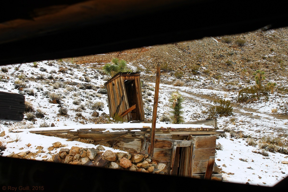
Lost Burro was a gold mine that operated off and on from 1907 into the 1970’s and was one of the most prosperous mines in the area. A good history of the mine can be found at the Death Valley Jim website. There is an intact miner’s cabin, a storage shed, the framework for the mill/cable car system, outhouse, and the mine entrance. The cabin is still furnished with a few basics (A chair, a table, bed frame and springs) and most flat surfaces are covered with artifacts that visitors have picked up and carried inside. All in all it looks like an excellent place to pick up the Hantavirus. A note from the BLM next to a sign-in book inside a plastic bag explains that the cabin has been treated, not that it occurred to ANY of us NOT to go inside beforehand.

Exact change please


 Michael and I checked out the cabin and shed while Tim and Gerry made their way to the top of the mill remains to suss out its function.

Entrance to the Lost Burro Gold Mine
After having a look around we followed and stuck our heads inside the mine entrance. I went in just as far as the light reached from the entrance. YOU SHOULD NEVER GO INSIDE AN ABANDONED MINE. This is a really good way to get dead with as little effort as possible.
Michael and I started to climb the hill toward the top of the mill and Gerry & Tim made truly pathetic efforts at hitting us with snowballs. Once we reached the top we were treated to what must be a spectacular view of the valley when the hills aren’t socked in with snow and fog. The entire structure has recently been stabilized with cables so watch your step.
The view from the top of the mill.

Ubehebe Crater
From there it was an almost entirely downhill run back to Ubehebe Crater. We stopped and got out and made our way down. As I am old and fat and out of shape I stopped about midway down the 700 foot deep crater. Michael ran all the way down to the bottom, “Flailing around like Grover” according to Gerry. Watching him below I had a bad moment where I thought he was going to take all his clothes off for some reason that wasn’t immediately evident. He stripped off his jacket, then lay down on the crater floor. When he came back up he said it was blazing hot at the bottom. I suppose the crater is deep enough that there would be a difference in barometric pressure and there is of course no breeze. Climbing back out took a good bit longer than sliding in. The sides of the crater are composed of loose black gravel. The ground shifts constantly under your feet, carrying you swiftly downward as you cover three times more distance than you would normally with each stride. Going back up…. you are quite literally carried backward one step for every two you take. By the time I reached the lip of the crater I was exhausted, and may have said a few dirty words to Gerry for pointing out that I had stopped to rest a mere ten feet from the top.
I sat on the bumper of good old Farabee’s Jeep Number 30 and tried to catch my breath. It had been a good trip, and I was exhausted. A trio of Chinese tourists passed by and smiled. One of the girls pointed to my ball cap and said “Dragon,” which cleared things up a great deal. My wife had purchased the hat for me in Hong Kong. I thought it said “Hong Kong.” She had, in fact, purchased it in Hong Kong during the Year of the Dragon. I told the girl I was just happy it didn’t say “Tourist,” got a blank look for a reply, and they went on their way. You learn something new every day if you aren’t careful.
We returned to Furnace Creek and loaded the gear back into my van, returned the Jeep, and drove home. We spent the next week stopping by each others’ homes and places of work returning bits of gear that had ended up in each others’ things. We laughed about the rain and the cold and the cuts on our hands from scrambling over the rocks and sorted out who owed who how much for the Jeep and food.
Can’t wait to do it again!
Take good care.

My LuminAID in action
P.S. I meant to mention this earlier… I took my LuminAID solar light on this trip and it did yeoman’s service in the rain. The light is a brilliant invention, the work of two graduate students after the earthquake in Haiti. You can purchase the original LuminAID or the new camping version from LuminAID.com. Do consider the option of buying a light and having another
donated for disaster relief.
© 2015 Roy Guill, The Naked Investigator
